Duration: 8:17hr
Elevation gain: 2'159m
Elevation loss: 2'664m
We had this route planned during the lockdown time we spent in Pany (CH). As we were looking out of the living room window and onto the mountain range in our view, we asked ourselves if it would be possible to run the entire range of mountains that we can see from the coach. So we went to SchweizMobil and sketched out the route and our plan was set, a roughly 40km trail run that we would do in the summer.

On July 19th, we finally got the chance to run the route. We took the first Postauto from Pany to Küblis at 8:30am and arrived by train in Küblis at 9:30am. The day was going to be really warm and we prepared by bringing 2l of water for each of us, as we thought it might be tough to find water along the way (but actually they are a few spots to refill it). The first part of the trail was going up mostly underneath the gondola all the way to Gotschna station. The trail is very wide and some of it is on a dirt road just next to the mountain bike downhill road. It's always tough to climb so many meters at the start of the trail, but we managed make good progress. From the trail we were also able to get a view into the next valley and we could see Piz Buin and Silvrettahorn in the distance. These were the two mountains we climbed the week before, such a cool sight to see them from the distance.
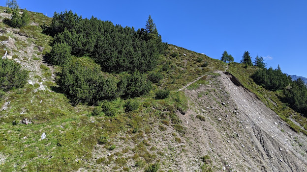
Once at Gotschna station you get a first good glimpse over the ski resort. We usually go here every winter and I've never actually been there in the summer. Looks very surreal to see the area all green and flatted out. The next section towards Casanna mountain (2'557m) is the steepest of the trail. As it's also the highest point of the route, we knew it will be less exhausting afterwards. The step section is made of switchbacks that make the height difference very efficient. The section just before and after the mountain (you actually can't climb all the way to the summit) travels along the side of the ridge. There are some chains at section where needed and it the trail is fairly steep. Once you're pass the mountain, the trail is much wider and travels along the ridge so you have views on both side. From here we were able to get a good view over Pany and the mountain. We called Zeno's parents who were at the cabin but they couldn't see us ;)
After running down to Parsennfurgga, you can see over onto the next section of the trail, a nicely runnable 8km section is ahead of us that passes by a nice lake, the Grüensee and through a little mountain town, Strassberg (there you can find a nice water fountain). There were quite some people around the lake and mountain bikers along the route. After leaving Strassberg, we tackled the last bigger mountain of the day, Mattjisch Horn (2'561m). The route we took was very steep along a grassy field. It was definitely a very efficient uphill climb. The sun was super strong and warm that day, but as we reached the top a cold wind was coming from the other side, it was actually kind of nice. We enjoyed the view on top, ate some bars and continued onto the last section of the trail along the ridge and then a long descend to Küblis. The ridge trail was very nice, it wasn't too step on either sides, but it wasn't running optimal. The downhill was long. The first 5km was very uneven, not runnable either. The last 5km however were nice and we managed to get some more running out of it.
After a total of 9:19hrs we made it back to Küblis, waited for the next bus to Pany and enjoyed a good shower back at the cabin. We looked outside the window again in the evening and were amazed by the sheer distance we just ran, it was incredible and I'd love to do it again soon.
 |
| Nice trail towards the Gotschna gondola station |
 |
| In the distance you can see the glacier with Silvrettahorn and Piz Buin |
 |
| Here you can see the switchbacks going up to Casanna |
 |
| Steep grassy section towards Mattjisch Horn |
 |
| What a nice ridge and view ;) |
 |
| This is the view from the mountain hut with the trail shown |


0 Comments